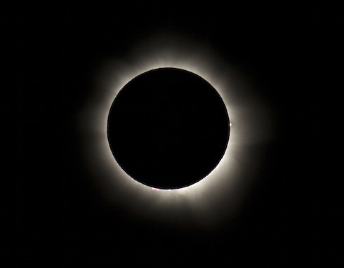
Where will the 2017 total eclipse times be longest? How to see The Most Totality

The 2017 total eclipse times might, at first, seem meager. Most cities in the path will see between one and two minutes of total darkness. Giant City State Park, in Carbondale IL, gets the Greatest Eclipse: two minutes and 41.6 seconds. And, for Americans, the whole thing will be over in about seven hours; the eclipse begins in Oregon at approximately 9:00 AM and ends off the South Carolina coast just after 4:00 PM.
Total darkness, however, is not all you’ll get if you’re lucky enough to either live in or travel to the eclipse path. Thanks to this handy dandy interactive graphic from Vox, it’s possible to know exactly how dark the sky will be at what time, along with the exact 2017 total eclipse times for your zip code. Starcasm Headquarters, for example, will see peak darkness at 1:10 PM local time, when 64.4% of the sun wll be obscured. Starcasm East will fare markedly better: 97.8% obscurity (suck it, Texas!) peaking at 2:36 PM.
Based on that information, and these handier-dandier NASA-produced maps of exactly where and when the 2017 total eclipse path will cross, we set out to answer the following question: Where, if one were so inclined, could one spend the longest time in the path of totality before the eclipse literally passed you by? Assuming you don’t have access to NASA’s eclipse-chasing jets, where could you go to most effectively and thoroughly drive your way into the darkness?
It probably comes as no surprise to learn that two of the three best entries in the 2017 Total Eclipse Road Atlas come out west. That’s not just because there’s more open road in the west: the angle of the eclipse is a little bit flatter from Oregon through Nebraska; it gets steeper starting in Missouri. And the first of the three is as western as you can get: specifically, the 44 miles of US Highway 26 that run between Dayville and Prairie City in Eastern Oregon’s John Day Valley. The eclipse will peak at 10:24 AM, but the half hour immediately before and immediately after that time will still be pitch-dark; you can make the trip from one town to the other while simultaneously nestled in between two mountain ranges and under a crazy sky.
The second extended stretch of west-east road in the eclipse path is US Highway 20 through Fremont County in Wyoming–the 70 miles between Shoshoni and Casper are about as straight as you’ll find. There, the eclipse peaks at 11:41, and the parameters of darkness are about the same.
After that, though, it’s tough to find a length that matches well for more than 20 or 30 miles–until you make it all the way back to the East Coast, where the path of totality starts to dip southward more aggressively. There, a long break of Interstate 26 is your best bet; the 62 miles from Clinton to Columbia look particularly favorable, given the relative lack of sizeable towns and heavily trafficked exits. The eclipse peaks at 2:41; it might actually be tough to make the full drive in about an hour, depending on how many other cars are on the road right then. Given the speed at which people normally drive in South Carolina, though, you’ll likely have no problems.
If you don’t live near one of these three stretches (or if you’re bummed that no one has RSVPed for your eclipse party because it’s on a Monday), fret not. The next total solar eclipse to cross the United States is only a few years off–and, while April 8th, 2024 is also a Monday, there’s a good chance that you can tie the festivities in to Spring Break. (If you want to *really* look ahead, the next eclipse to touch the U.S. after that will take place on August 12, 2045, which is indeed a Saturday.)
(Photo credits: 2017 total eclipse times via Nicholas Jones on Flickr)


